About Moree
Registrar Placement Incentives are available
Our City
Situated on the banks of the meandering Mehi River, surrounded by shimmering, startlingly flat horizons and dazzling night skies, Moree is a dynamic and historic town, rich in cultural heritage, natural assets and agricultural bounty. With a thriving arts scene and sporting, recreational and special events calendar, Moree is well known for its welcoming, social, and resilient community.
Moree Plains Shire is located 640km northwest of Sydney, 473km southwest of Brisbane and is a 1hr 20min drive to the Queensland border, with the primary transport routes being the Newell Highway (which connects Victoria with Queensland) and the Gwydir Highway (linking the east coast with western NSW). The Shire is bordered on the eastern side by the scenic Nandewar Ranges, which provide a striking, artist-drawn outline behind the seemingly endless plains which stretch as far as the eye can see.
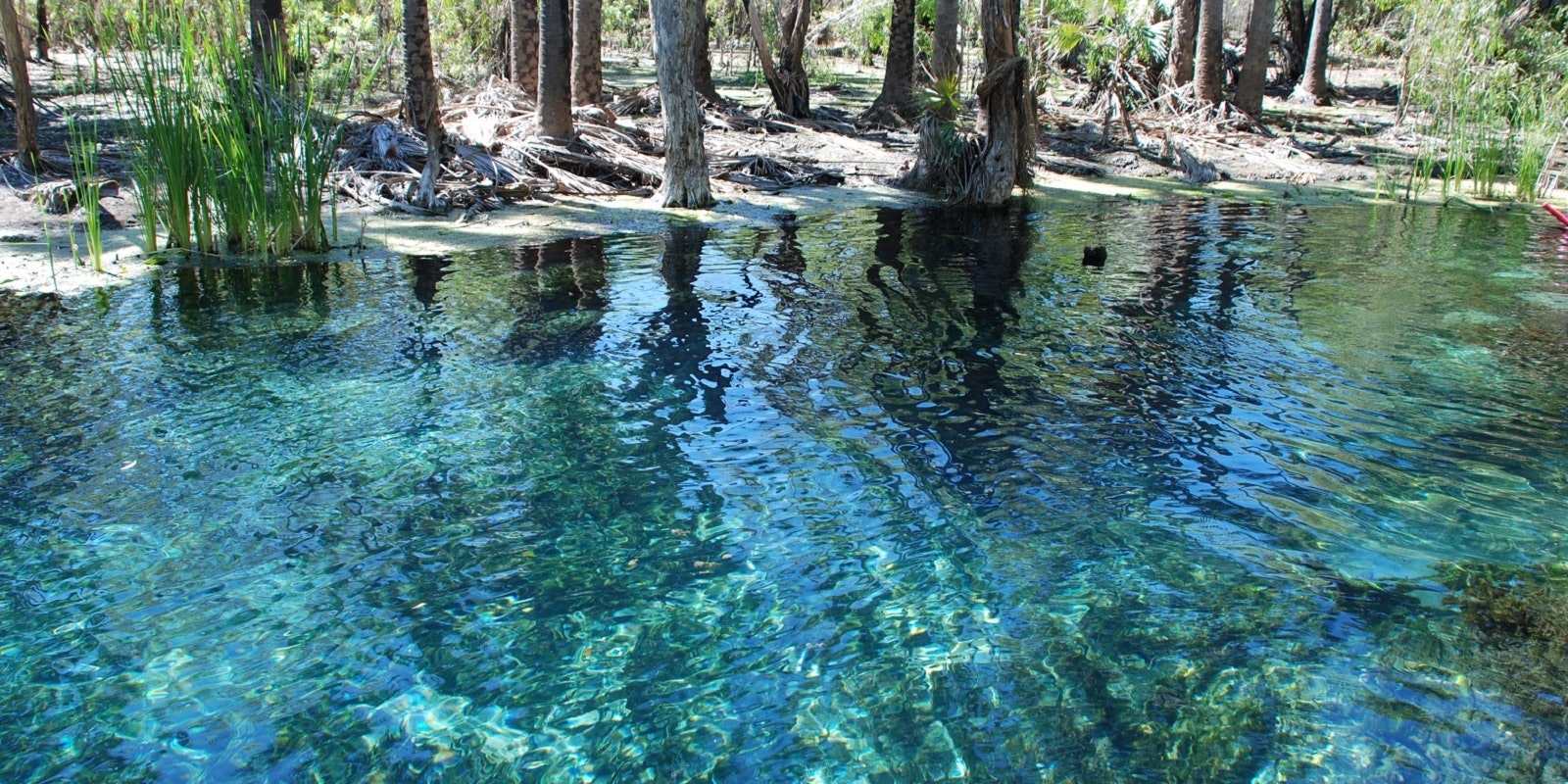
The Gwydir, Barwon and Macintyre rivers also flow through the Shire and in stark contrast to most of our nation’s inland regions, Moree has an abundant supply of water. The area overlies the Great Artesian Basin and has access to extensive underground water resources, first tapped in 1895, earning the town its status as the Spa Capital of Australia. The mineral-rich waters rise to the surface in hot natural springs and bores and are a major tourist attraction and great asset to the district.
The fertile black soil plains, combined with innovative, progressive farming techniques and technologies have made Moree Plains Shire one of the most agriculturally productive local government areas in Australia. Export industries for the region include large scale cotton and cereal cropping, while livestock, oil seeds, olives and pecan nuts contribute significantly to the local and national economy.
Moree has a surprisingly wide variety of dining options for its size, including fresh and modern pub grub, cafes with caffeine hits worthy of the fussiest coffee addict and menus featuring an abundance of local and seasonal produce, plus, Thai, Indian and Chinese cuisine.
Moree has warm to hot summers (18˚C–33˚C), lovely, moderate spring and autumn and winters of mild, clear days and crisp, frosty nights (4˚C–19˚C).
The local government area encompasses approximately 17,930 square kilometres and includes the townships and villages of Ashley, Biniguy, Boggabilla, Boomi, Bullarah, Garah, Gurley, Mungindi, Pallamallawa, Terry Hie Hie and Weemelah.
Aboriginal communities managed by Local Aboriginal Land Councils are located at Toomelah, near Boggabilla, and at Mehi Crescent and Stanley Village in Moree. The Shire is home to an estimated 13,160 residents with a median age of 38 years, 81 per cent were born in Australia and the majority claim Australian, English and Irish ancestry.
Our History
The first inhabitants of Moree Plains Shire were the people of the Kamilaroi Nation (also known as Gamilaroi or Gamilaraay), which extended from the Hunter Valley through to the Warrumbungle Mountains in the west, through Quirindi, Tamworth, Narrabri, Walgett, Moree and Mungindi in NSW to Nindigully in southwest QLD.
They are the second largest Aboriginal Nation on the east coast of Australia. Today, their descendants continue to occupy these lands and are known as 'Murri' people - for further information on their rich cultural history and local sites of significance, drop into the fascinating Dhiiyaan Aboriginal Centre in Albert St.
The surveyor and explorer Major Sir Thomas Mitchell went to the district in 1832 following orders from the acting governor after a recaptured escaped convict (who had been living with the Kamilaroi people) told of a great river in the area. Squatters followed soon after, establishing pastoral runs, among which was 'Moree' (1844). In 1852, a general store was built on the bank of the river, followed by a post office and inn, then in 1862 Moree was officially gazetted as a town.
Agriculture soon thrived on the fertile flood plains. Local wheat cultivation increased after World War II, cotton kicked off in the early 1960’s and the first commercial pecan nut farm was established in 1966. Moree is now home to the largest pecan nut farm in the southern hemisphere.
In 1965, Moree was one of the destinations of the famous Freedom Bus Ride – inspired partly by civil rights campaigns in America and lead by Charles Perkins. The highly significant trip through northern NSW aimed to bring media attention to the living conditions, discrimination, and racial segregation of Indigenous Australians in rural Australia. At the time, Aboriginal people were forbidden entry to many public venues including the Moree pool, pubs, and theatres. After a tense confrontation at the pool with Freedom Riders, Council, pool management and members of the community, it was agreed that Indigenous children attend outside school hours. This was the beginning of the gradual end to segregation in the town.
There are exciting times ahead for Moree, with the new Inland Rail project well underway - a 1,700km freight rail line connecting Melbourne to Brisbane and passing through the town and Shire between Narrabri to North Star and North Star to the NSW/QLD border. The multi-billion-dollar construction project will bring major economic investment to the district and create ongoing opportunities for the community.

Charles Perkins speaks to Aboriginal residents at Moree. Tribune/SEARCH Foundation, Mitchell Library, State Library of New South Wales
The Freedom Ride was both a fact-finding mission and a protest against racial segregation.