Explore Moree's National Parks
Mount Kaputar National Park - Image: Visit Narrabri

NSW National Parks app
Explore over 225 parks from your pocket – compatible with Android and Apple devices.
Terry Hie Hie Aboriginal Area – 45min drive from Moree
Stretching north of the Mt Kaputar National Park, the area encompasses many significant cultural sites for the local Gamilaroi people (Gamilaraay, Kamilaroi, Gomeroi) and protects ceremonial and art sites, tool-making areas, burial sites and hunting grounds. The picnic area features fascinating interpretive signage, BBQs, picnic shelters and is the beginning of the Yana-y Warruwi Walking Track - a scenic 3.2km loop through the beautiful landscape surrounding the township of Terry Hie Hie.
Terry Hie Hie Rd, Terry Hie Hie. Park Map
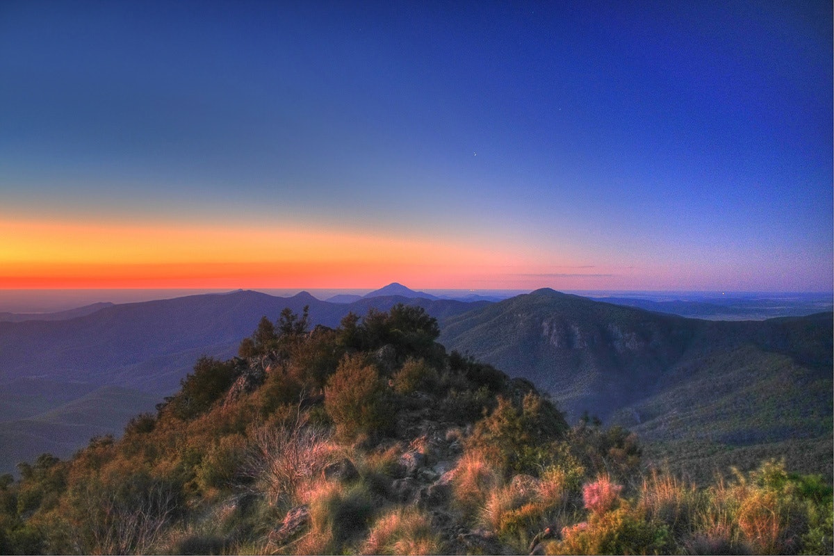
Mount Kaputar National Park
Whether you’re a thrill seeker or seeking blissful solitude, take the time to discover this rugged island of wilderness left behind by ancient volcanic eruptions between 17 and 21 million years ago. The Nandewar Ranges rise dramatically from the flat agricultural plains below, the elevation resulting in a great variety of vegetation, landscape and temperature. The park is home to rare and threatened fauna, including bats, birds, koalas, quolls and wallabies. Keep an eye out for the distinctive native pink slug, which is unique to the area!
Camping, bushwalking, mountain biking, rock-climbing, swimming, horse riding…the options for adventure are endless. Contact the Moree Visitor Information Centre on 02 6757 3350 before venturing out to check current road conditions. Park Map
Highlights of the park include:
- Mount Kaputar Summit lookout – 2hr drive from Moree
Spectacular, panoramic 360- degree views taking in an extraordinary 10% of the state. If you’re keen for a hike, start at the Dawson’s Spring picnic area and follow the trail along the Mount Kaputar Summit Walk (2km return).
- Waa Gorge Walking Track – 1hr 10min drive from Moree
Millions of years of weathering has formed the deeply etched gorge, its gullies are strewn with enormous boulders and the ghost of ancient rivers and streams. Follow the track (2.5km return through the Grattai Wilderness Area) deep into the rock formation and be dwarfed by the towering tangerine-streaked walls up to the volcanic plug. Wildflowers carpet the area in springtime and it’s a cool and quiet spot for a picnic in summer. Picnic tables and bush toilets near the carpark at the base of Mt Waa.
Allambie Rd, Berrigal
Soaring, 40m tall pillars reminiscent of church organ pipes, Sawn Rocks is a perfect example of the park’s volcanic past - the striking wall of pentagonal basalt pipes is the result of slow and even cooling of molten rock. From the carpark a 1.5km return walking track offers an easy stroll through fragrant eucalypts, fig and wattle trees to an observation platform providing the perfect view of this intriguing geometric formation. You can then take the steps down for a dip in the tranquil pools of Bobbiwaa Creek. BBQ, picnic tables and bush toilets.
Killarney Gap Rd, Narrabri